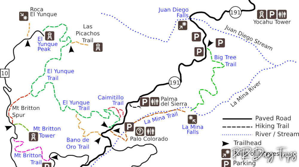
El Yunque Trail Map
Update- 9/23- All of El Yunque has NOT yet reopened after the hurricanes. Most trails are open, but La Mina Trail and Big Tree Trail and Bano de Oro Trail trails have not yet reopened. They are being worked on and we will post when they have reopened.
The El Yunque National Forest has many trails, streams, rivers and waterfalls that can be enjoyed year-round. Though the forest covers 28,000 acres, when most people (especially tourists) speak of "going to the rain forest" they’re referring to the Recreation Area on the north side of the Sierra de Luquillo Mountains. The "main road" into this area is state road 191. This map shows the trails and roads within the Recreation Area maintained by the US Forest Service.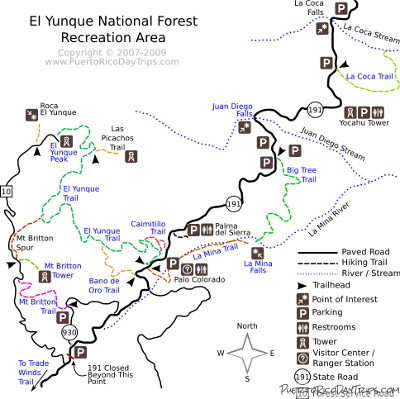
We’ve marked the hiking trails with different colors. There’s no significance to the colors. We just wanted to be able to make the different trails "stand out" on the map. Please note that you can click on the blue labels in the map for more information.
If you’d like to print a map to take with you, check out this larger version of our El Yunque Trail Map that’s more suitable for printing. Clicking the link will open the map in a new window.
El Yunque National Forest is open 7 days/week, year-round. N191 trails/areas are open 8:00am- 5pm, Yokahu Tower closes at 4:30pm. Gates close at 5:30pm
The conventional route- Take Route 3 toward Rio Grande and Luquillo. Coming from the west, you can either turn off RT 3 at the sign that says RT 191 and take that right up. Or if you miss that (or are coming from the east) You’ll see a sign pointing El Yunque (RT 955). Turn off of Route 3 at that corner (Eureka gas station). Follow the little road (955) for about 1 minute and you’ll see a sign for road 191 pointing up to the rain forest.
PuertoRicoDayTrips.com assumes no responsibility regarding your safety when participating in the activities described in this article. Please use common sense! If your mother or that little voice in your head tells you that you are about to do something stupid … then don't do it!